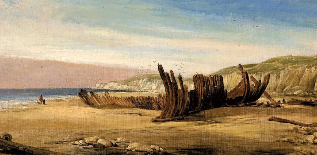
Above: Thomas Clark’s painting The Mahogany Ship.
Quite taken by the path Deep Creek carves into the foreshore as I trudged through Torquay’s White’s Beach seaweed recently. Heading straight out to sea for a change.
Surprising. Not long before, it ran parallel to the beachline before clunking to a halt. Other times, it’s barely made it under The Esplanade, all gummed up and tea-stained.
Sand, dunes, rivers … hardly the most permanent things around. Look at Thirteenth Beach Road. Not surprising to hear scientists have tracked down an ancient branch of the Nile that once ran right up to Cairo’s Giza pyramids.
Made life much easier transporting the giant masonry the Egyptians needed for their pharaonic tombs. These days, underground water soaks up into the pyramids via busted sewer pipes.
Scientists say Egypt, and the Sahara, weren’t desert at all 6000 years back. The earth’s orbital wobble in space maybe but the mystery Nile branch maybe also vanished to windblown sand and drought, says North Carolina University’s Eman Ghoneim.
Curious stuff alongside other river/coastal oddities. Like the Piri Reis and Oronteus Finaeus maps of the 1500s showing subglacial rivers, mountains and the coast of Antarctica.
Extraterrestrials? Pre-Ice Age civilisations? No, I’m not going all Erich von Daniken, Antarctica froze up 30 million years ago. Long time for maps to last.
Besides, modern researchers have discovered ancient rivers underneath Antarctica, too. More likely, the maps are just coincidence although I do like the April 1 scientist gags about Roman ruins in Antarctica.
Dunes are notorious for shifting, and presumably why Warrnambool’s Mahogany Ship disappeared, if it didn’t become firewood.
Geelong’s late Ken McIntyre plumbed it in The Secret Discovery of Australia, also highlighting that maps can be peripatetic too.
Purportedly a Portuguese caravel secretly surveying Australia, the Mahogany Ship’s course might have been plotted on the mysterious Dauphin Maps. Or not.
These squiggly maps lack the maths to be viewed as a rectangular map of the globe. When the Mercator Projection is applied, they resemble Australia’s east coast – stopping dramatically at Warrnambool.
Critics, however, argue the maps could also be Vietnam’s coast. Go figure.
You have to love some Aussie crypto yarns. The late Rex Gilroy cited an Egyptian pyramid near Cooktown plus Egyptian, Phoenician, Libyan and Celtic rock scripts along the Darling, Murrumbidgee, Lachlan and Murray.
Locally, you’ll find creeks have disappeared that once ran down the likes of Gordon Avenue, Coquette Street and many other thoroughfares. Swamps have been drained and created, coastal land reclaimed, a waterfall at Fyansford has even evaporated.
Mind you, rewriting history, as much as rivers or map-lines, can be intriguing.
Take the 820AD Baghdad discovery of Australia, drafted by Persian Muhammad Ibn Musa al-Khwarizmi, Likewise, a 934AD revisit attributed to al-Istakhari.
Want to know more, look up Geelong’s Dzavid Haveric. Yep, with a Z. He’s been rewriting a lot of stock history notions, not just the Anglo-Saxon Biblical giant-killer’s name, which was originally Dawid in Hebrew by the way.
Must ask him what he thinks of Deep Creek ….
This article appeared in the Geelong Advertiser 28 May 2024


